GreenSight’s WeatherHive Takes Flight for INFUSSE Field Campaign
In early September, GreenSight operated the ScoutHive near the shoreline of St. Augustine, Florida. GreenSight participated as one of eight teams spanning private companies, national laboratories, and universities for the International Society for Atmospheric Research using Remotely piloted Aircraft (ISARRA) Northern Florida UAS Sampling of the Shoreline Environment (INFUSSE) field campaign hosted by Embry-Riddle Aeronautical University (ERAU). The event marked the first ever BVLOS operations with WxUAS over a populated area in the United States. Teams were split across two east-west transects running from the coastline inland to capture the evolution of the sea breeze and convective initiation.
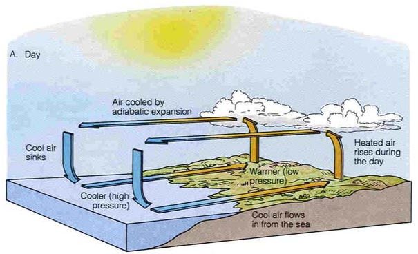
The Sea Breeze
The sea breeze is a daytime coastal circulation created by differential heating of air over land and water. The sun more rapidly heats the air over land, increasing its buoyancy and causing it to rise and be replaced by cooler air from above the water. Rising air then makes its way over the ocean as it cools and replaces the air flowing inland at lower altitudes, completing the circulation. The edge of the cool air flowing inland is commonly referred to as the sea breeze front (SBF). The SBF gradually moves inland up to 10s of miles throughout the day. As the SBF passes through, air temperatures typically decrease, relative humidity increases, wind direction shifts toward a stronger inland component, and can also trigger thunderstorms along the boundary.
Student Opportunity
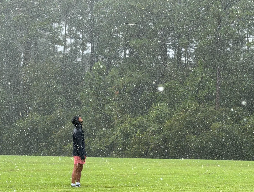
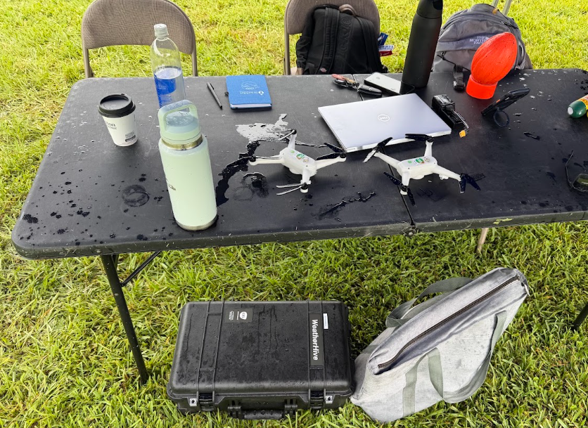
Several students with backgrounds in engineering and UAS operations from ERAU engaged in the five-day long operating period with GreenSight. Students were given hands-on experience with the WISP drones and ScoutHive base station, observing data transmitted back to the ScoutHive in real time as flights were conducted. On September 1, single WISP profiles were flown every 20 minutes up to 1100 ft above mean sea level (MSL). On September 2 and 3, single WISP profiles were continued at a reduced cadence while a second WISP hovered at 105 feet to match the altitude of a nearby atmospheric sensing tower. Students operated with GreenSight in heavy rain, air temperatures up to 90 ℉, heat indices up to 100 ℉, and winds speeds up to 25 knots.
Science Results
The SBF passages occurred early in the day on all of the operating days. The local time in Florida was Eastern Daylight Savings Time, or four hours behind Universal Time Coordinates (UTC). The latest SBF passage occurred on September 1 just after 10:00 am local time. SBF passages were observed at 9:00 am and 9:30 am local time on September 2 and 3, respectively.
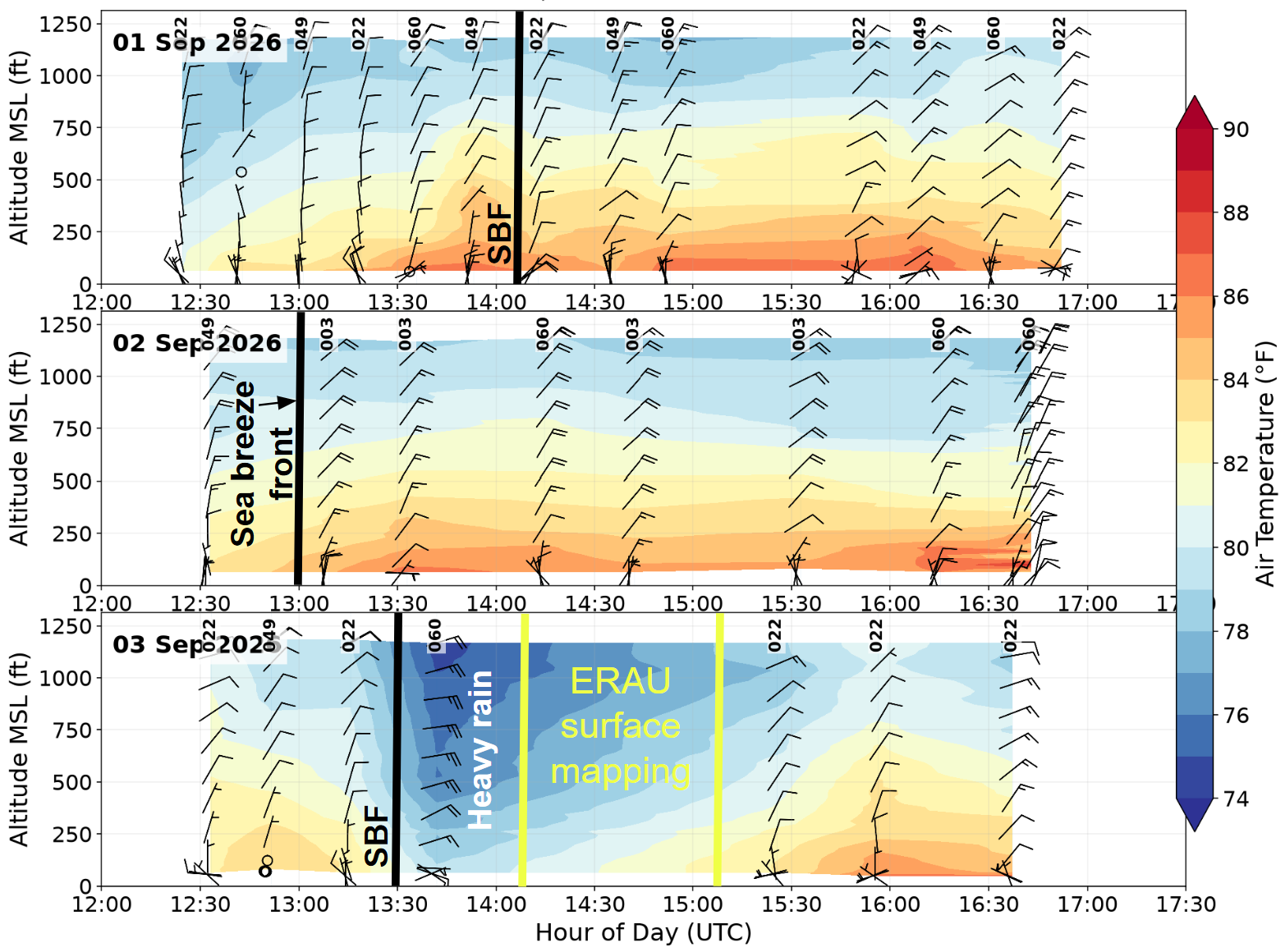
All SBF passages were associated with a shift in wind direction from northerly to northeasterly or easterly, indicating the onset of the sea breeze circulation at the site. The passage on September 1 experienced an air temperature decrease of around 1 ℉ and relative humidity increases around 5% throughout the profile. Thermodynamic changes were not evident in the September 2 passage, possibly due to the earlier passage time limiting heating of the air prior to the SBF passage.
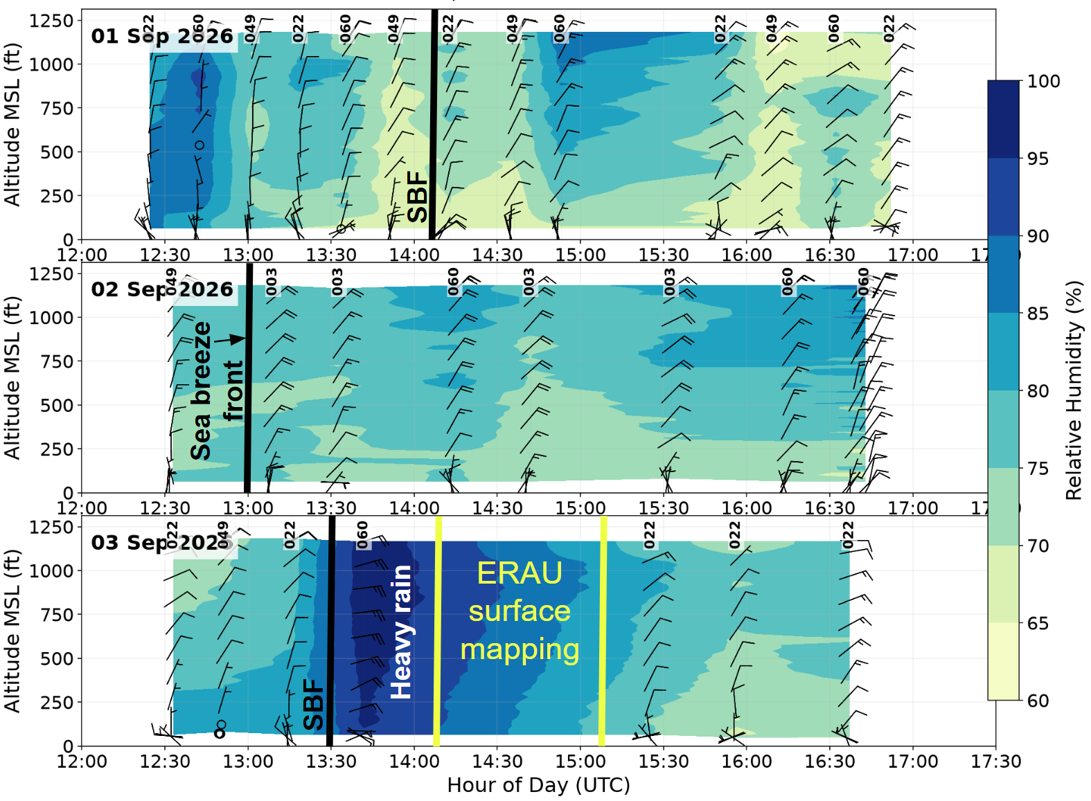
On September 3, the SBF passage was accompanied by a 30-minute heavy rain shower. The rain decreased air temperatures by around 5 ℉ and increased relative humidity by around 20% throughout the profile with an observed relative humidity maximum of 99.3%. Wind speeds associated with the heavy rain storm exceeded 25 knots (29 mph) at around 800 ft MSL. The heavy rain marked a new threshold for both the WISP and ScoutHive, which had previously operated in lighter rain. This event tested the new WISP 3.0 design and lid-closed ScoutHive operation concept in heavy rain conditions. The ScoutHive and both WISPs flown in the heavy rain successfully completed the mission with no issues.
About WeatherHive
WeatherHive is a swarm of autonomous weather drones that lets a single operator collect high-resolution atmospheric data wherever the weather matters most. Small WISP drones launch from the ScoutHive base station to fly vertical profiles, hold position as virtual meteorological towers, map an area, or sample along a route. At INFUSSE, that meant repeated profiles every 20 minutes alongside a second WISP holding steady at tower height, all managed from one browser-based interface and streamed back in real time. Instead of waiting for the weather to come to a fixed sensor, WeatherHive sends the sensor into the weather. Whether the mission is coastal research, forecasting, wildfire monitoring, or operational planning, the system adapts to the science rather than the other way around.
Recent Blog Posts
GreenSight operated its ScoutHive and WISP drones during the INFUSSE field campaign in St. Augustine, Florida, successfully capturing coastal sea breeze dynamics and demonstrating reliable performance even in heavy rain.
GreenSight's WeatherHive drones revealed a hidden forest-edge microclimate at Ashton Prairie, giving STEM camp students a hands-on look at how airborne sensing uncovers weather patterns surface stations miss.
GreenSight trained University of Oklahoma and NOAA researchers in drone swarm operations to support the 3D Mesonet — a NOAA-contracted statewide weather monitoring system using autonomous drones to improve forecast accuracy.


