WeatherHive Senses Ashton Prairie Microclimate for Weather Resilience STEM Camp
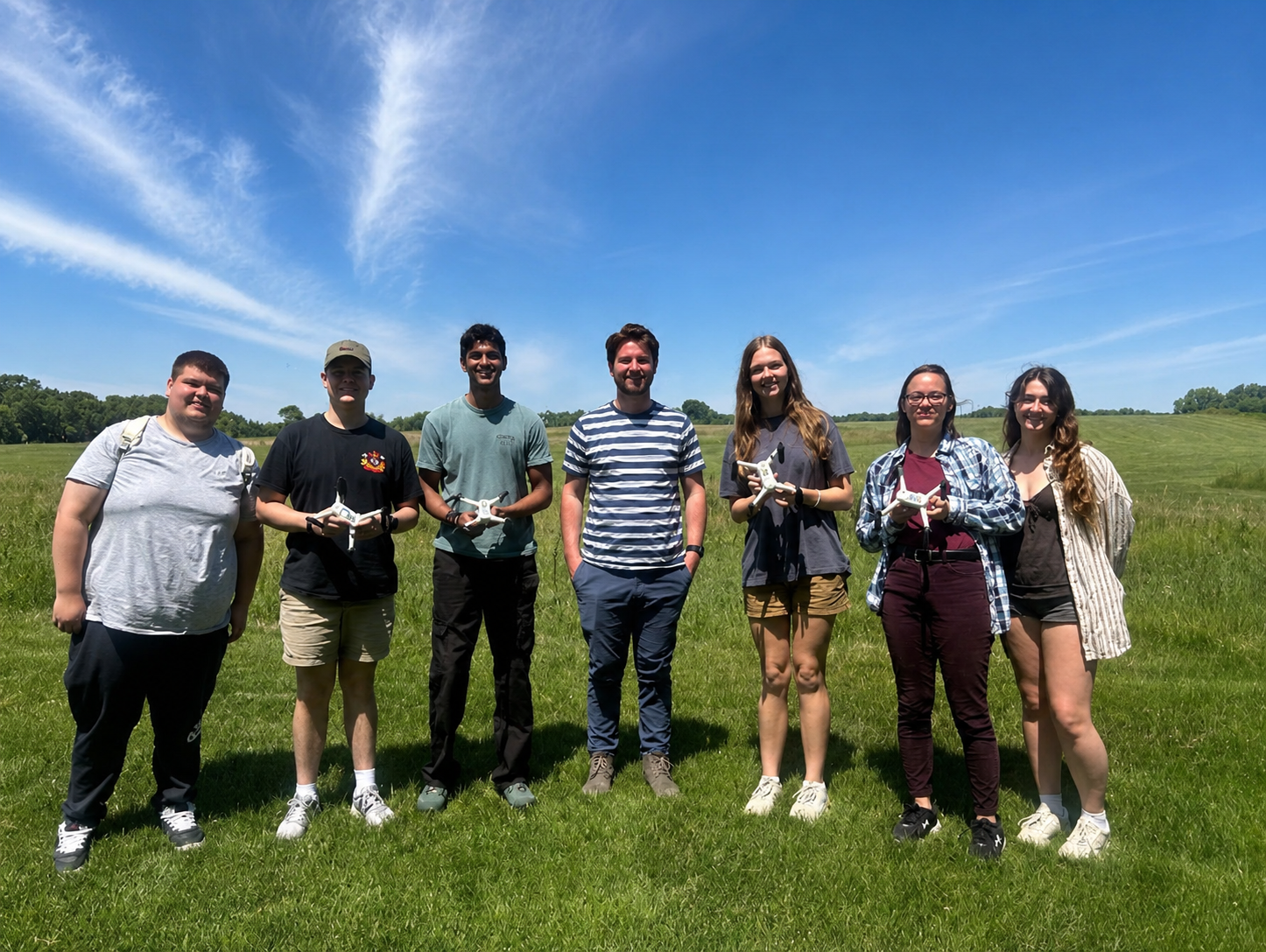
In June, GreenSight operated the WeatherHive atmospheric sensing system as part of a Science, Technology, Engineering, and Mathematics (STEM) summer camp focused on weather intelligence and community resilience. The camp was supported through the National Science Foundation's Established Program to Stimulate Competitive Research (NSF EPSCoR), a collaboration among the University of Iowa, the University of Arkansas, Kansas State University, and the University of Nebraska–Lincoln. Hosted this year by the University of Iowa, the week-long program introduced students to weather intelligence, environmental sensor development, uncrewed aerial systems (UAS), and artificial intelligence (AI). WeatherHive was a natural fit, demonstrating how emerging drone technology can collect atmospheric observations while supporting GreenSight's commitment to STEM education.
Mapping a Microclimate from the Air
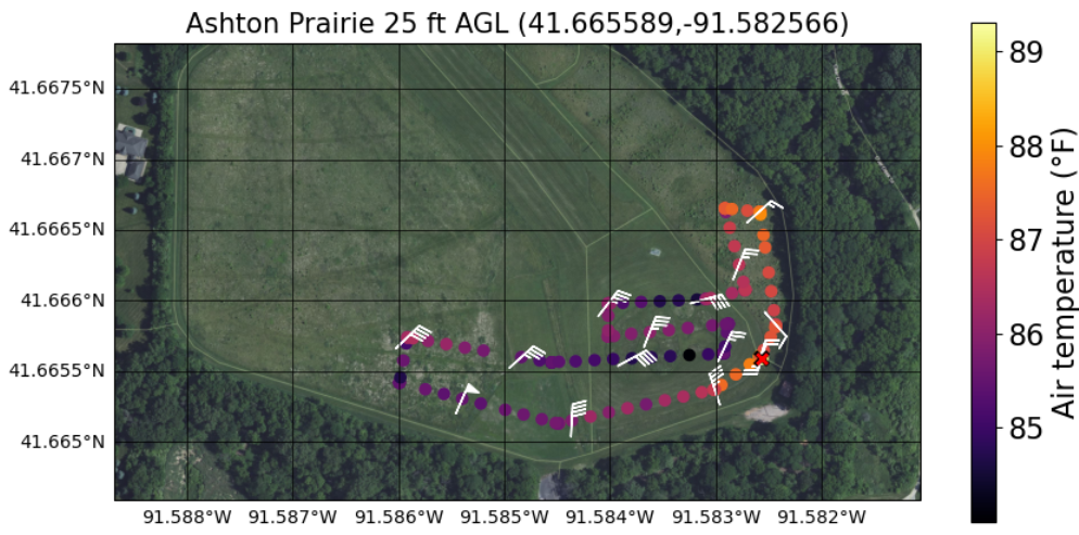
During the field exercises, GreenSight conducted a series of swarm flights over Ashton Prairie using vertically stacked lawnmower patterns at 25, 50, and 350 feet above ground level (AGL). These coordinated flights allowed students to observe how weather conditions change not only across the landscape but also with height. At approximately 2:00 PM CDT, WeatherHive identified a distinct forest-edge microclimate along the eastern boundary of the prairie. Air temperatures within the sheltered region were 3–5°F warmer than the surrounding open prairie, while wind speeds were reduced to 2–4 knots compared to 8–10 knots in exposed areas (in the plot below, long barb is 2 kts; flag is 10 kts). Wind direction was also more variable within the sheltered zone, whereas the open prairie experienced consistent northerly to northeasterly winds. Humidity measurements generally indicated slightly higher absolute humidity near the forest edge. These observations suggest that afternoon solar heating warmed the eastern prairie surface and the adjacent tree line. Downwind of the trees, reduced wind speeds limited turbulent mixing, allowing warm air to remain concentrated near the surface and creating a forest-edge microclimate extending approximately 150 feet into the prairie, or about twice the distance of the canopy height.
Why Forest Edges and Shelterbelts Matter
Forest edges and shelterbelts have long been recognized for their ability to modify local weather conditions. By reducing wind speeds, they help decrease soil erosion, limit evaporation, improve soil moisture retention, and create more favorable growing conditions for vegetation. These same principles inspired the Great Plains Shelterbelt, established through the Prairie States Forestry Project during the 1930s and 1940s in response to the Dust Bowl. Today, shelterbelts continue to provide numerous benefits, including reducing weather extremes, improving water infiltration and groundwater recharge, supporting biodiversity and pollinator habitat, increasing carbon storage, and promoting healthier soils. Together, these effects contribute to greater agricultural productivity and stronger community resilience.

From the Classroom to the Field
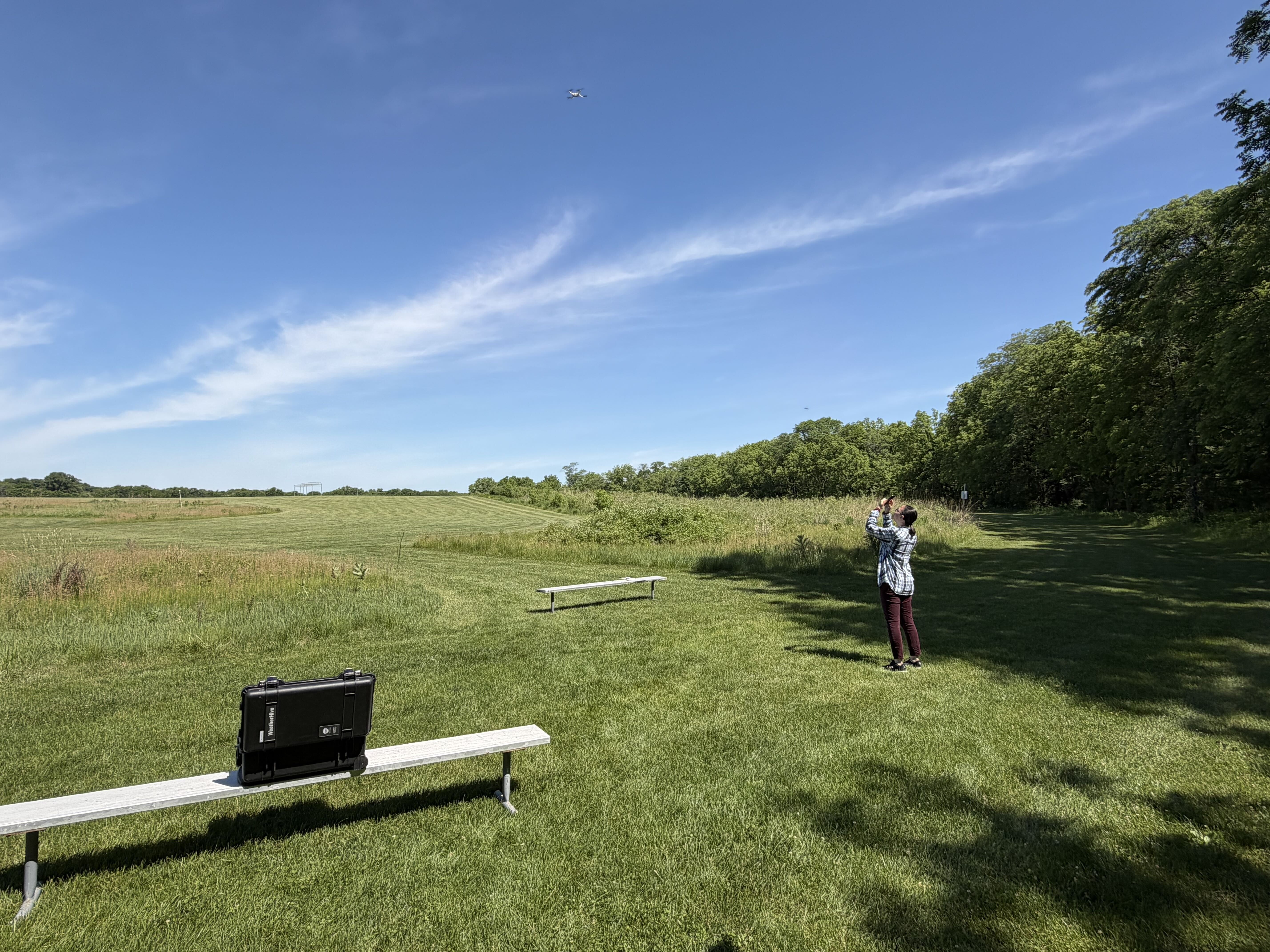
Students were introduced to WeatherHive in the classroom before participating in field operations. They observed system setup, preflight inspections, safety procedures, and FAA 14 CFR Part 107 operating requirements before watching live weather data stream from the aircraft to the Hive command-and-control station. The hands-on experience gave students direct exposure to nano-UAS operations, atmospheric sensors, and real-time environmental data collection. Back in the classroom, they analyzed WeatherHive observations collected at multiple flight altitudes alongside measurements from surface weather stations distributed throughout Ashton Prairie. The week concluded with student poster presentations highlighting their findings and demonstrating how airborne observations can reveal weather patterns that conventional surface stations alone may miss. By combining cutting-edge atmospheric sensing technology with experiential learning, WeatherHive gave students an opportunity to explore how drones, weather observations, and data analytics can help scientists better understand local environments and build more resilient communities.
Recent Blog Posts
GreenSight's WeatherHive drones revealed a hidden forest-edge microclimate at Ashton Prairie, giving STEM camp students a hands-on look at how airborne sensing uncovers weather patterns surface stations miss.
GreenSight trained University of Oklahoma and NOAA researchers in drone swarm operations to support the 3D Mesonet — a NOAA-contracted statewide weather monitoring system using autonomous drones to improve forecast accuracy.


